SceneDraw 1.0
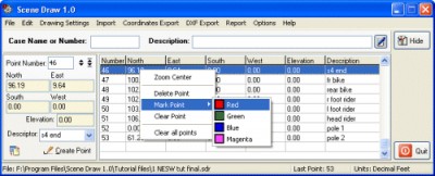
 SceneDraw is an investigative tool, for police and private investigators that need to survey and diagram scenes for criminal and civil litigation.
|
SceneDraw is an investigative tool, for police and private investigators that need to survey and diagram scenes for criminal and civil litigation.
Scene Draw is not a CAD program nor is it a drawing program, it is a Data Driven Diagram software program for your reconstruction purposes.
It is the complete data measurement collection software tool for Microsoft Windows 98 to XP. Whether you are collecting data points with a tape measure, an electronic distance meter or a total station, SceneDraw is just what the investigator has needed.
SceneDraw is not a CAD drawing software.
SceneDraw features
Limitations
tags![]() you can north east east south south west polar angle angle distance scenedraw coordinates various formats gathering all report gathering openoffice document can also export options
you can north east east south south west polar angle angle distance scenedraw coordinates various formats gathering all report gathering openoffice document can also export options

Download SceneDraw 1.0
Purchase: ![]() Buy SceneDraw 1.0
Buy SceneDraw 1.0
Similar software
 SceneDraw 1.0
AK Corp and Delicad
SceneDraw is an investigative tool, for police and private investigators that need to survey and diagram scenes for criminal and civil litigation.
 Points Export for AutoCAD 1.0
Floating Point Solutions Private Limited
Points Export for AutoCAD is a plug-in for AutoCAD.
 Survey Import & Export 2005 3.0
CADD Productivity
Survey Import & Export works with AutoCAD (dwg) and coordinate data in formats such as txt, ascii, and csv.
 Points Import for IntelliCAD 1.0
SYCODE
Points Import for IntelliCAD is a Point Text file import plug-in for IntelliCAD powered applications.
 DiagramDraw 1.01
DiagramDraw.com
Diagram Draw represents a easy-to-use diagram create software.
 MyPlot Chart Editor 1.0
YPS software
MyPlot is the analogue of text editors in the area of plotting.
 Precision Image Digitizer 1.1
Michael Robinson
With Precision Image Digitizer you can trace and record the coordinates of your selected points in a JPG, GIF, or BMP.
 InnerSoft CAD for AutoCAD 2007 3.8
InnerSoft
InnerSoft CAD is a add-on component for AutoCAD that allows you to: Export to a Excel Sheet the values of Area/Length property or coordinates for various AutoCAD entities.
 TopoLT 5.2
S.C. 3D Space S.R.L.
TopoLT is a very useful application for those who design topographical or cadastral plans in digital format.
 RapidDXF 4.0
DeliCAD
RapidDXF is a program that will allow you to import topographic datas in your CAD system.