RoboGEO 6.3.2
 Georeference digital images with latitude, longitude, and altitude information.
|
Georeference digital images with latitude, longitude, and altitude information.
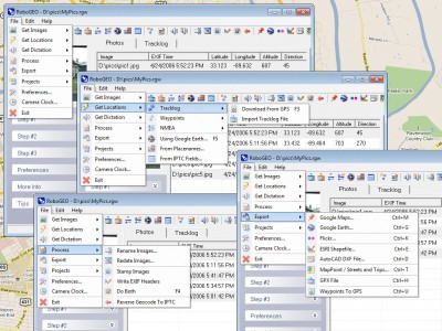
RoboGEO stamps this information onto the actual image and writes it to the JPG's EXIF headers, allowing you to permanently geocode and link the digital photo to the GPS coordinates.
Now you can know WHERE a given photo was taken.
RoboGEO can write the latitude, longitude and altitude to the image's EXIF headers.
RoboGEO works with any digital camera that produces EXIF format images (virtually all do) and includes direct support for Garmin GPS units, but no GPS is actually required.
RoboGEO can import G7ToWin tracklog files for interfacing with other GPS makes and models. Very easy to use. Perfect tool for hikers, boaters, realestate agents, and geocaching. Low cost. Extensive on-line documentation.
tags![]() robogeo can exif headers and altitude longitude and latitude longitude
robogeo can exif headers and altitude longitude and latitude longitude

Download RoboGEO 6.3.2
Purchase: ![]() Buy RoboGEO 6.3.2
Buy RoboGEO 6.3.2
Similar software
 RoboGEO 6.3.2
TimTech Computer
Georeference digital images with latitude, longitude, and altitude information.
 RoboImport 1.2.0.66
PicaJet.com
RoboImport is a Camera and CardReader Image Automation software.
 Exif Date Changer 1.1
Greg Driver
EXIF Date Changer modifies the date and time attributes of the EXIF data in your digital photos.
 GPS Altitude Chart 1.2
Michael Steger
Did you ever want to print or publish the altitude profile of a tracklog recorded with a GPS receiver? As long as you are using Garmin software you probably were not too happy - at least I wasn't! Now there is a better way to generate an elevation plot:
GPS Altitude Chart application is one solution to these problems.
 Exif Reader 3.0
Ryuuji Yoshimoto
Exif Reader allows you to view the EXIF information contained in pictures taken with digital cameras.
 AmoK Exif Sorter 2.52
AmoK - The Art of Coding
AmoK Exif Sorter is a free and useful utility that renames photos according to their EXIF-data (that are the information like capturing date) that have been written to the photo-file by the digital camera.
 OziPhotoTool 2.8
OziPhotoTool
OziPhotoTool combines the technology of a GPS receiver and a digital camera to automatically keep a record of where digital photos were taken.
 DigiPhoto Gallery 2.25
Wizard Software
Publish your digital photos on the web with this powerful yet easy to use program.
 EXIF Viewer 2.5
Softplicity Development
You will estimate at its true worth this new handy utility if you deal with digital photos.
 Exif It Toolbar 1.0.0.4
DigiCobra
Increasingly most pictures we take are from Digital Cameras.