MagicMap 2.00
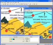
 MagicMap is a software for extracting color layers from scanned images - topo maps and logos.
|
MagicMap is a software for extracting color layers from scanned images - topo maps and logos.
tags![]()

Download MagicMap 2.00
Purchase: ![]() Buy MagicMap 2.00
Buy MagicMap 2.00
Similar software
 MagicMap 2.00
Two Pilots
MagicMap is a software for extracting color layers from scanned images - topo maps and logos.
 Img2CAD 7.6
Img2cad, Inc.
Img2CAD is a stand-alone program that converts scanned drawings, maps and raster images into AutoCAD formats (such as DXF, HPGL, etc) for editing in any CAD application.
 Raster to Vector Standard 9.6
Raster to Vector, Inc.
Raster to Vector is a stand-alone program that converts scanned drawings, maps and raster images into accurate vector files (such as DXF, HPGL, WMF, EMF, etc) for editing in any CAD application.
 Raster to Vector Normal 9.6
Raster to Vector, Inc.
Raster to Vector Normal is a stand-alone program that converts scanned drawings, maps and raster images into accurate vector files (such as DXF, HPGL, WMF, EMF, etc) for editing in any CAD application.
 Raster to Vector Gold 9.6
Raster to Vector, Inc.
Raster to Vector Gold is a stand-alone program that converts scanned drawings, maps and raster images into accurate vector files (such as DXF, HPGL, WMF, EMF, etc) for editing in any CAD application.
 ExpertGPS 2.3.4 Beta 7
TopoGrafix
ExpertGPS is the ultimate mapping software for Garmin, Magellan, and Lowrance GPS owners.
 Color Pilot 4.80
Invention Pilot, Inc
Color Pilot is specifically designed for natural and easy color correction of digital camera or scanned images.
 ICE Color 1.4
ICE Graphics
ICE Color is specifically created for Image Enhancement and Color Correction of digital camera or scanned photo images.
 WEB MAPS 1.0
SharewareLab
WEB MAPS allows you to search maps of any country, state, city or province.
 Stitch Maps 2.40
Petr Bezdecka
The maps used as basis for the assembly were either created by scanning templates, or by exports from digitalized maps.