XLPoints Plus 1.3
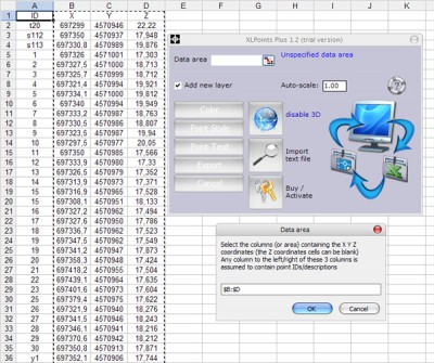
 XLPoints Plus is the easiest application to massively draw points in AutoCAD and generate 3D models using coordinate data in Excel.
|
XLPoints Plus is the easiest application to massively draw points in AutoCAD and generate 3D models using coordinate data in Excel.
XLPoints Plus features
Requirements
AutoCAD 2004 or later
tags![]() xlpoints plus points using coordinate data using coordinate draw points
xlpoints plus points using coordinate data using coordinate draw points

Download XLPoints Plus 1.3
Purchase: ![]() Buy XLPoints Plus 1.3
Buy XLPoints Plus 1.3
Similar software
 XLPoints Plus 1.3
Productivity Tools
XLPoints Plus is the easiest application to massively draw points in AutoCAD and generate 3D models using coordinate data in Excel.
 Points Export for AutoCAD 1.0
Floating Point Solutions Private Limited
Points Export for AutoCAD is a plug-in for AutoCAD.
 Terrain for AutoCAD 1.1
SYCODE
Terrain for AutoCAD is a terrain modeling plug-in for AutoCAD.
 Points Import for AutoCAD 1.0
Floating Point Solutions Software
Points Import for AutoCAD is a plug-in for AutoCAD.
 PIX Import for AutoCAD 1.0
Floating Point Solutions Software
PIX Import for AutoCAD is a plug-in for AutoCAD.
 GPS2CAD 3.5
AzTechSoft
GPS2CAD allows you easily and inexpensively use recreational-grade GPS units to collect field information and plot it in their CAD software.
 Graph 4.4.2
Ivan Johansen
Graph is an open source application used to draw mathematical graphs in a coordinate system.
 Pointor 6
Ransen Software
Pointor will import text files which are lists of points (2D or 3D) and save them as DXF files.
 OBJ Import for AutoCAD 1.0
Floating Point Solutions Software
OBJ Import for AutoCAD is a plug-in for AutoCAD.
 FlashPoints 1.0
DeliCAD
FlashPoints is a tool for creating and managing points Groups (topographic points for example).