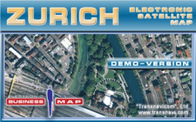
Transnavicom Satellite Map of Zurich 1.0
 Demo-version of Satellite Map of Zurich!
Transnavicom Satellite Map of Zurich is one of the newest progressive experience and developments of Transnavicom (www.
|
Demo-version of Satellite Map of Zurich!
Transnavicom Satellite Map of Zurich is one of the newest progressive experience and developments of Transnavicom (www.transnavi.com), professionalism of our specialists, aspiration and wish to do our favourite thing give us a chance to create such high-quality and unique products! Face the reality!
Your dreams are coming true with satellite maps from Transnavi.com. In the demo-version you can get acquainted with a district of Zurich, use address-search functions and measure the distance between any number of points!
Basic properties of the programme demo-version:
tags![]() the map demo version information about any number between any satellite map transnavi com
the map demo version information about any number between any satellite map transnavi com

Download Transnavicom Satellite Map of Zurich 1.0
![]() Download Transnavicom Satellite Map of Zurich 1.0
Download Transnavicom Satellite Map of Zurich 1.0
Similar software
 Transnavicom Satellite Map of Zurich 1.0
Transnavicom LTD
Demo-version of Satellite Map of Zurich!
Transnavicom Satellite Map of Zurich is one of the newest progressive experience and developments of Transnavicom (www.
 Zurich Show Screensaver 1.02
EasyZurich.com
Zurich Show Screensaver is a slideshow with 25 pictures of urban landscapes of various areas in Zurich (Lindenhof, Guild houses, Old town (Altstadt), District 1, Bahnhofstrasse, Parade-Platz, Botanical Garden of the University of Zurich, Chinese Garden, Zurich, Neu Oerlikon, Lake Zurich, Uetliberg, Fluntern Cemetery and more.
 StreetFinder 3.0
DolSoft Incorporated
StreetFinder - This software helps the user to find streets, administrative places, tourist places… in big cities of Vietnam such as: Ho Chi Minh, HaNoi, Hue, Da Nang, Nha Trang, Da Lat, Bien Hoa, Can Tho, and especially in this new version, version 3.
 PDF Measure It 1.08
Traction Software
PDF Measure It is an Acrobat plug-in tool, it enables accurate measurement of the distance and angle between two points on a page.
 Night City 3D Screensaver 1.0
Astro Gemini Software
The bright lights of the night city are inviting! This fascinating animated 3D screensaver will take you on a fly-by tour around the streets of the city that never goes to sleep.
 Universal Desktop Ruler 3.2
AVPSoft
Rulers are great for straight line distances, but would a ruler be a good choice to measure the length of a river or road? What if you are measuring a distance along roads from one city to another? How would you measure curved lines with a straight ruler?
Universal Desktop Ruler allows you to measure not only a straight line distance but any curved distance on the Screen.
 A3D JMapping 1.0
Anything3D Corporation
3D JMapping applet allows to integrate easily extended GIS features such as map browsing, address searching and trip calculations into your web site.
 MainStreetMapbooks 2.28
MainStreetGIS
MainStreetMapbooks is a plug-in designed for ArcGIS that easily creates a custom mapbook from an ArcMap project.
 Daily Picture Of Zurich 1.0.1
sam
 Google Earth 4.0.2722
Google
With Google Earth you can explore the earth from above!
Want to know more about a specific location? Dive right in -- Google Earth combines satellite imagery, maps and the power of Google Search to put the world's geographic information at your fingertips.