InnerSoft CAD for AutoCAD 2007 3.8
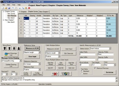
 InnerSoft CAD is a add-on component for AutoCAD that allows you to: Export to a Excel Sheet the values of Area/Length property or coordinates for various AutoCAD entities.
|
InnerSoft CAD is a add-on component for AutoCAD that allows you to: Export to a Excel Sheet the values of Area/Length property or coordinates for various AutoCAD entities.
Import from a Excel Sheet the vertex coordinates for a set of 2D polylines or 3D polylines (you can choose between 3 different methods).
You can also import a set of points from Excel or a set of Texts with a insertion point for every one. Sum the area or length property of a set of entities. Sum accumulated distance of a user defined walk in the drawing. Triangulate a set of points or mesh a model surface.
InnerSoft CAD for AutoCAD 2007 features
Requirements
tags![]() coordinates for you can sheet the length property excel sheet every one from excel one sum for every point for insertion point sum the texts with
coordinates for you can sheet the length property excel sheet every one from excel one sum for every point for insertion point sum the texts with

Download InnerSoft CAD for AutoCAD 2007 3.8
![]() Download InnerSoft CAD for AutoCAD 2007 3.8
Download InnerSoft CAD for AutoCAD 2007 3.8
Purchase: ![]() Buy InnerSoft CAD for AutoCAD 2007 3.8
Buy InnerSoft CAD for AutoCAD 2007 3.8
Similar software
 InnerSoft CAD for AutoCAD 2007 3.8
InnerSoft
InnerSoft CAD is a add-on component for AutoCAD that allows you to: Export to a Excel Sheet the values of Area/Length property or coordinates for various AutoCAD entities.
 Points Export for AutoCAD 1.0
Floating Point Solutions Private Limited
Points Export for AutoCAD is a plug-in for AutoCAD.
 Points Import for AutoCAD 1.0
Floating Point Solutions Software
Points Import for AutoCAD is a plug-in for AutoCAD.
 PIX Import for AutoCAD 1.0
Floating Point Solutions Software
PIX Import for AutoCAD is a plug-in for AutoCAD.
 STL Export for AutoCAD 1.0
Floating Point Solutions Software
STL Export for AutoCAD is a plug-in for AutoCAD.
 OBJ Export for AutoCAD 1.0
Floating Point Solutions Private Limited
OBJ Export for AutoCAD is a plug-in for AutoCAD 2, 2i, 2002 and 2004.
 FlashPoints 1.0
DeliCAD
FlashPoints is a tool for creating and managing points Groups (topographic points for example).
 TopoLT 5.2
S.C. 3D Space S.R.L.
TopoLT is a very useful application for those who design topographical or cadastral plans in digital format.
 Cadig AutoTable for AutoCAD LT 3.3
Cadig.com
Cadig AutoTable for AutoCAD LT was designed to provide AutoCAD LT users a more convenient way working together with AutoCAD and Excel.
 Terrain for AutoCAD 1.1
SYCODE
Terrain for AutoCAD is a terrain modeling plug-in for AutoCAD.