GIS ObjectLand 2.7.9
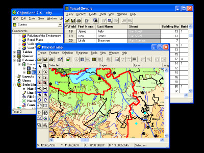
 GIS ObjectLand is a universal Geographic Information System utility that allows you to do many things , as it is displayed in the features below.
|
GIS ObjectLand is a universal Geographic Information System utility that allows you to do many things , as it is displayed in the features below.
GIS ObjectLand features
tags![]() between different and moving different geoinformation geoinformation databases the map table information merging and copying merging layers and arbitrary structure and feature feature types and editing
between different and moving different geoinformation geoinformation databases the map table information merging and copying merging layers and arbitrary structure and feature feature types and editing

Download GIS ObjectLand 2.7.9
Purchase: ![]() Buy GIS ObjectLand 2.7.9
Buy GIS ObjectLand 2.7.9
Similar software
 GIS ObjectLand 2.7.9
Radom-T
GIS ObjectLand is a universal Geographic Information System utility that allows you to do many things , as it is displayed in the features below.
 DB Navigator 3.0.0
Desktop Software
DB Navigator is an application for the work with database tables of the DBF format.
 GIS Explorer 1.0 Build 061120 RC2
BMT Cordah
GIS Explorer is a user friendly freeware Geographic Information System from BMT Cordah.
 Cross-Database Studio 5.0
Cross Database Solutions
Cross-Database Studio 5.
 PassportODBC odbcv10
Embassy Software Inc
PassportODBC is a tool that works as an ODBC Viewer and will let you View or edit any ODBC enabled database.
 Tables Transformer for Excel 1.1.4
Office Assistance LLC
Tables Transformer for Excel will allow you to fast and easy perform the following transformations of Microsoft Excel tables:
· To prepare tabular data for the construction of pivot tables.
 dfbUtils standard 2.15
GW Associates
Database Editor/Utility at its Best.
 B&P Table Utilities 2.2.0.2
B&P Technoloies
B&P Table Utilities is a software tool for maintaining Paradox database tables.
 NetSET 1.2.2
DATA INVEST
The power of Spatial Editing Tool
NetSET by Data Invest is a powerful GIS solution designed for supporting the decision making process by helping to create, visualize, analyse and present the information in the best effective way.
 Interactive SQL for MySQL 2.2
microOLAP Technologies LLC
MyISQL (Interactive SQL for MySQL) is a handy utility for working with MySQL tables and queries.