GridImp 2.4
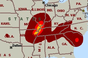
 Imports gridded data into Microsoft MapPoint, to produce attractive data maps that resemble contour maps.
|
Imports gridded data into Microsoft MapPoint, to produce attractive data maps that resemble contour maps.
Can handle imperfect data, holes, re-gridding, etc. Can be used to import such attributes as pollution data, seismic hazard, geological information, customer/population distribution, etc. Data can be interpolated to different grid spacings if required. Polygon optimization algorithms reduce the drawing time, as well as GridImp's cpu & memory requirements.
GridImp: Import Gridded Data into Microsoft MapPoint.
Various text formats supported using space, tab, or comma separators with both Unix and DOS/Windows newline conventions. Data coordinates can be longitude,latitude coordinates; custom linear coordinates; or UK Ordnance Survey Grid References.
GridImp can add data to an existing map or template; allowing it to be used with such products as the Single State Mapper or other MapPoint add-ins.
Predefined or user-defined color schemes can be used. These can include transparent 'gaps' as well as attractive color gradations.
Requirements
Limitations
tags![]() microsoft mappoint into microsoft data into gridded data
microsoft mappoint into microsoft data into gridded data

Download GridImp 2.4
Purchase: ![]() Buy GridImp 2.4
Buy GridImp 2.4
Similar software
 GridImp 2.4
Winwaed Software Technology
Imports gridded data into Microsoft MapPoint, to produce attractive data maps that resemble contour maps.
 Grid Imp 2.2
Winwaed Software Technology
Grid Imp - imports gridded data into MS-MapPoint, to produce attractive data maps.
 Single State Mapper 1.0
Winwaed Software Technology LLC
Single State Mapping Tool lets you create maps of individual states with Microsoft MapPoint 2002 or 2004.
 RouteWriter 2.11
Winwaed Software Technology LLC
Have you ever tried to export route pushpins from Microsoft MapPoint, only to find that MapPoint does not preserve their route order?
If so, then RouteWriter will solve your problem.
 SF3 Photoflight Tools 1.006
Aerograffects
SF3 is a package of tools created to help organize, map, and managing photo flight projects and flight lines.
 Panoply 2.1.4
Robert B. Schmunk
Panoply is a Java application which enables the user to plot raster images of geo-gridded data from netCDF datasets.
 QuikGrid 5.3
Perspective Edge Software
QuikGrid is an application which will read in a set of scattered data points (x, y, z) which represents a surface.
 Pushpin Tool 2.4
Winwaed Software Technology LLC
Pushpin Tool v2.
 Surfer 2.0.1
Golden Software Inc
Surfer is a contouring and 3D surface mapping program that runs under Microsoft Windows.
 MileCharter 2.12
Winwaed Software Technology
MileCharter is a program that will calculate Mileage Charts and Tables with MS MapPoint.