Tiles2kml 2.31
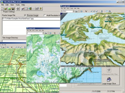
 T2K or tiles2kml will enable you to efficiently load large set of imagery or raster maps very quickly into google earth using Region-Based Network Links.
|
T2K or tiles2kml will enable you to efficiently load large set of imagery or raster maps very quickly into google earth using Region-Based Network Links. This method has an onRegion option, which specifies to load the Region data only when the Region is active.
So only the needed set of data is loaded with multiple levels of detail, larger amounts of data are loaded only when the user's viewpoint triggers the next load. Tiles2kml converts your imagery into very small tiles with different level of details allowing very quick view for very large datasets without loosing the image quality.
Tiles2kml generate very small image tiles that can be servered locally or your PC or your intranet. You can even share your imagery through the internet using the custimized kml files that links google earth client to the small tiles on your webserver. So sharing your large imagery over the internet became a very quick and easy process.
Limitations
tags![]() small tiles very quick the internet very small your imagery the region only when when the google earth
small tiles very quick the internet very small your imagery the region only when when the google earth

Download Tiles2kml 2.31
Purchase: ![]() Buy Tiles2kml 2.31
Buy Tiles2kml 2.31
Similar software
 Tiles2kml 2.31
Tiles2kml
T2K or tiles2kml will enable you to efficiently load large set of imagery or raster maps very quickly into google earth using Region-Based Network Links.
 Tiles2kml Pro 2.31
Tiles2kml Pro
T2K Pro integrates the rich world of GIS datasets and transfers your Geographic information data into Google earth.
 Google Earth 4.0.2722
Google
With Google Earth you can explore the earth from above!
Want to know more about a specific location? Dive right in -- Google Earth combines satellite imagery, maps and the power of Google Search to put the world's geographic information at your fingertips.
 WW2D 0.99.88 RC1
Vitaliy Pronkin
WW2D is cross-platform, free and open-source version of NASA World Wind software, see http://worldwind.
 Keyhole LT 2.2.990
Keyhole Inc.
Keyhole 2 LT is a software application that you download and install.
 Catfood Desktate 2.22.0003
Catfood Software
Catfood Desktate is a useful and reliable eye catching earth simulator that combines satellite imagery, near real time cloud data and optional layers including political borders, time zones and place names.
 Image Fiddler 1.0
Brian Shepherd
Image Fiddler is a small program that will allow you to view a large image in a small window by either stretching it to fit or by allowing you to scroll around the image using the mouse.
 Liquib 2.5
Jeff L. Holcomb
Liquib is a graphics tool (or toy) that attempts to translate mathematics into visual imagery.
 MapContacts for Google Earth 2.0
Windswept software
MapContacts is an powerful add-in for Outlook, ACT! and Goldmine that allows you to quickly map and view a satellite image of your contact's location.
 40tude Time 1.0
Marcus Mönnig
40tude Time is an application that contains 5 programs: Clock, Synchronizer, Wallpaper, Calendar and Screensaver.